RIS
RIS (River Information Services) is a system that aims to improve the safety of navigation and streamline water transport on inland rivers. RIS are information technology (IT) related services designed to optimise traffic and transport processes in inland navigation, i.e. to enhance a swift electronic data transfer between water and shore through in-advance and real-time exchange of information. RIS aims to streamline the exchange of information between waterway operators and users (www.ris.eu).
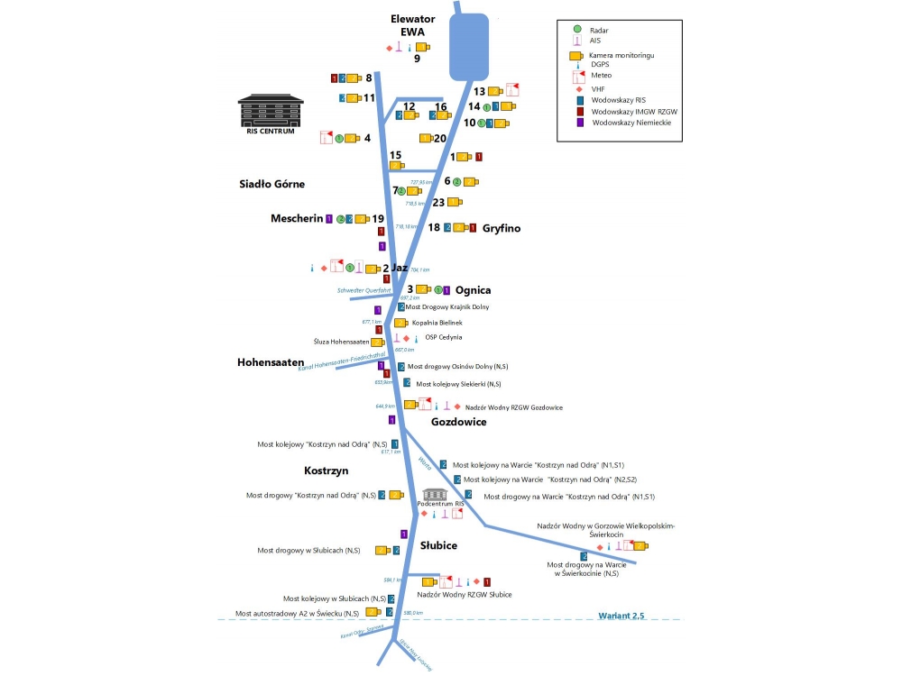
In Poland, the system covers 97.3 kilometers of waterways of the lower Oder river from Ognicy to Szczecin, together with the Oder Eastern, Western Oder and Lake Dabie.
Pilot implementation of RIS for Lower Oder was launched in December 2013. Following the success of pilot implementation Inland Navigation Office in Szczecin commissioned preparing of the documentation for a full implementation of RIS.
Consortium of companies Marine Technology Sp. z o.o. and Lemtech Consulting Sp. z o.o. developed a Functional and Utility Program, which is available below:
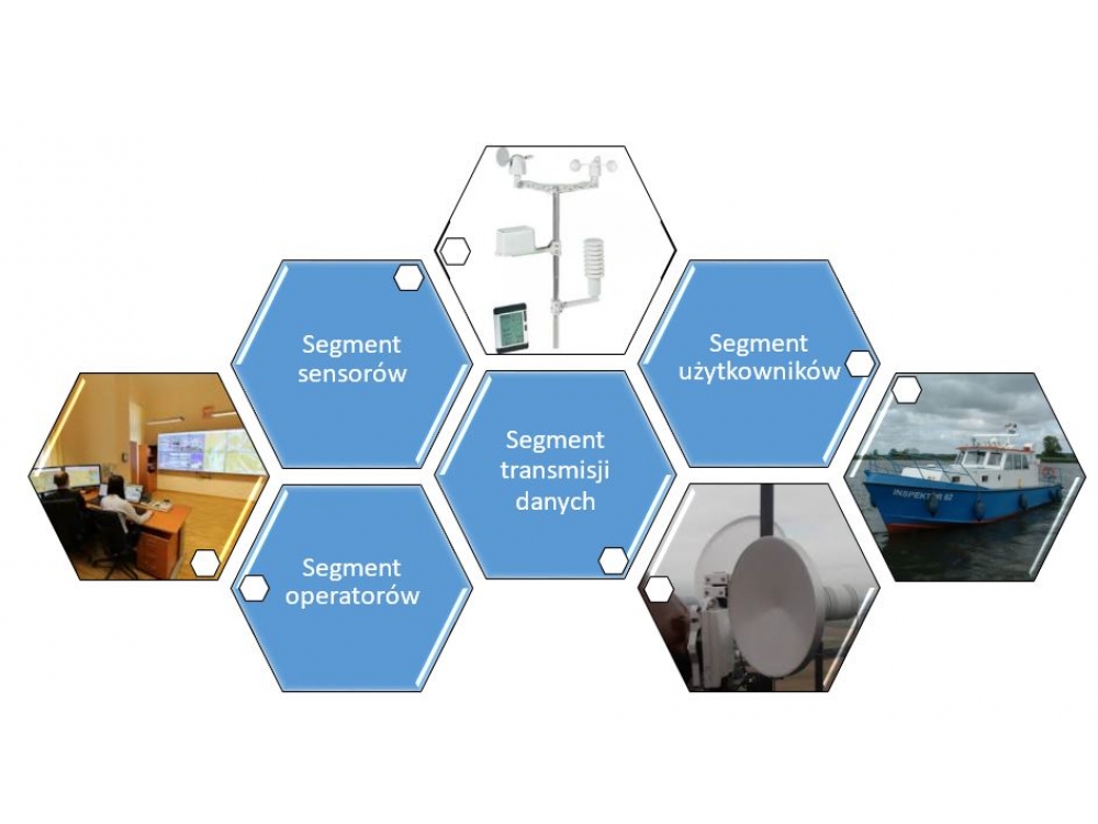
The concept presented in PFU assumes:
increasing geographical coverage of RIS,
installations of the gauges on every bridge in the area of the RIS (usually doubled),
construction a new part of the data network,
expansion of video system,
the expansion of existing sensor networks (without radars),
ensure full coverage of the AIS, DGPS and VHF on an area of RIS system,
extension of the existing data networks,
construction of the new headquarters of RIS Center.
Address
4/6 Roszczynialskiego St.
81-521 Gdynia
13/5 Niemena St.
81-603 Gdynia
37/5 Klonowica St.
71-248 Szczecin