UAV

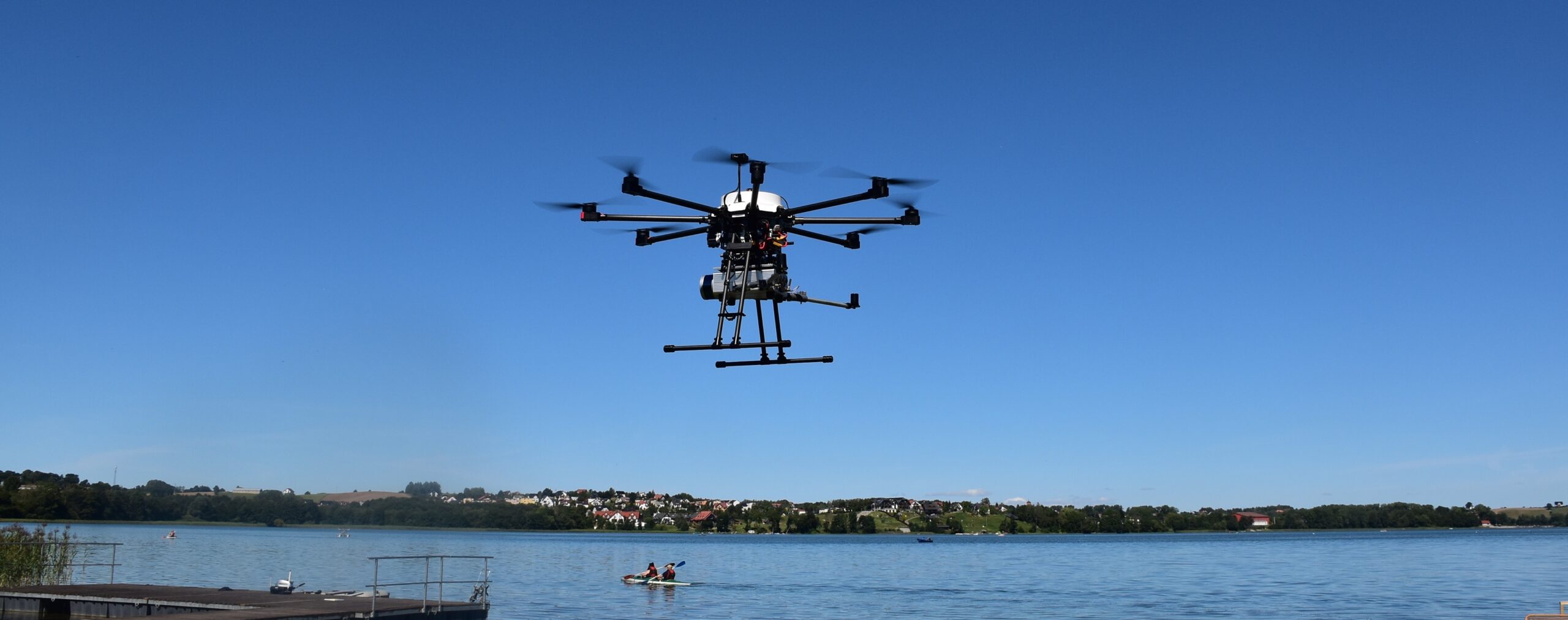
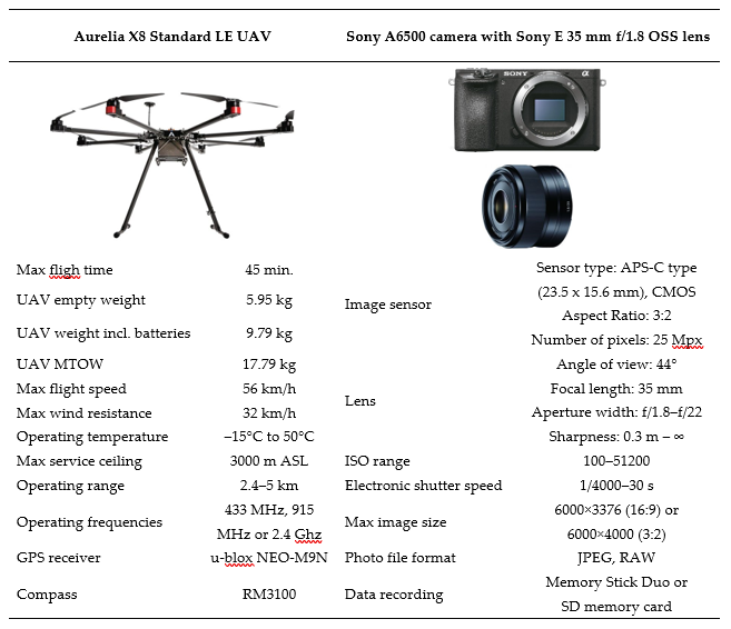
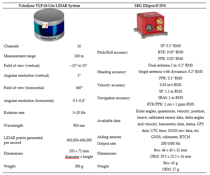
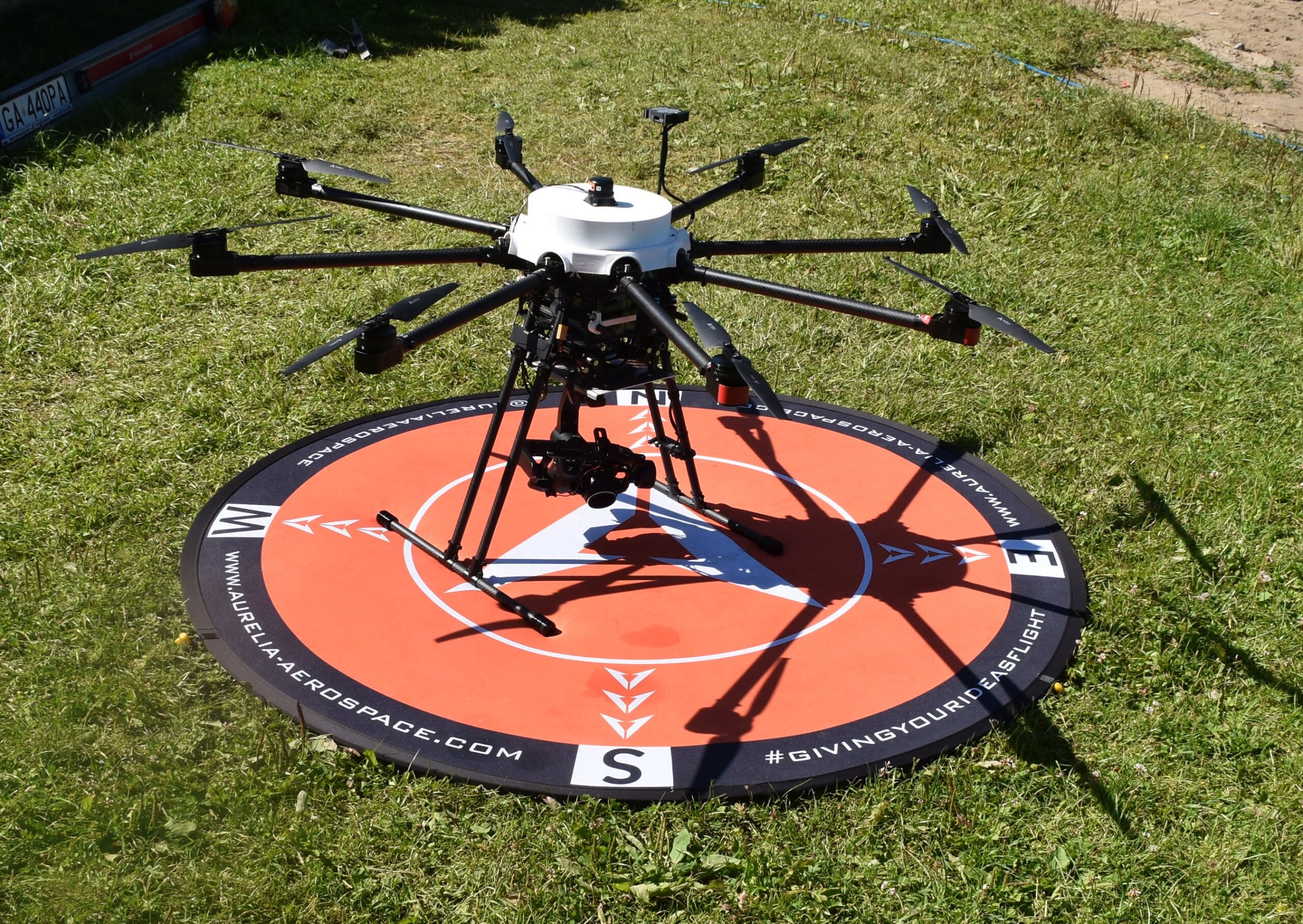
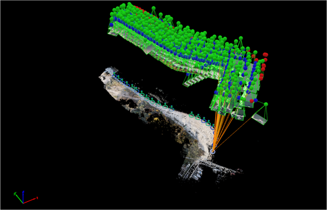
Marine Technology owns the Aurelia X8 Standard LE UAV Unmanned Aerial Vehicle. A proprietary chassis was created for the drone. The UAV is equipped with the following equipment: a Sony A6500 camera with a Sony E 35 mm f/1.8 OSS lens, a Velodyne VLP-16 LiDAR system, and an SBG Ellipse-D positioning system.
We offer professional laser scanning and orthophotomap creation services using the Aurelia X8 Standard LE UAV drone. Thanks to modern technology and the high precision of our systems, we provide accurate photogrammetric data that is widely used in various industries.
If you need precise field data, contact us and take advantage of the most modern solutions available on the market.
Laser scanning (LiDAR)
Our services include low-altitude laser scanning, which allows for the creation of detailed models of terrain and objects, identification of changes in terrain, and height measurements with centimetre accuracy.
Creating orthophotomaps
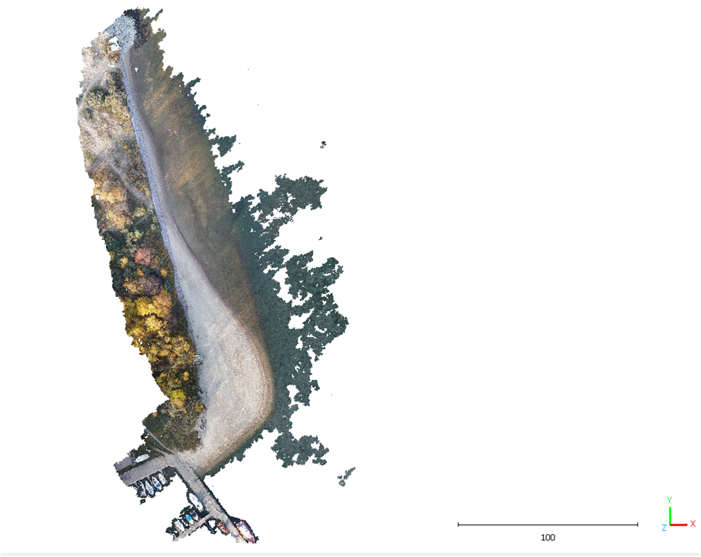
Our offer also includes high-resolution orthophoto mapping. This process involves taking low-altitude aerial photos and creating precise terrain maps based on the photos.
Thanks to LiDAR technology, we are able to obtain detailed point clouds that can be used for 3D modeling, spatial planning and many other applications.
Orthophotomaps are irreplaceable in cartography, precision agriculture, environmental monitoring, construction and many other fields.
Address
4/6 Roszczynialskiego St.
81-521 Gdynia
13/5 Niemena St.
81-603 Gdynia
37/5 Klonowica St.
71-248 Szczecin