The next stage of the 4DShoreMap project is behind us

Two years of the project are behind us!
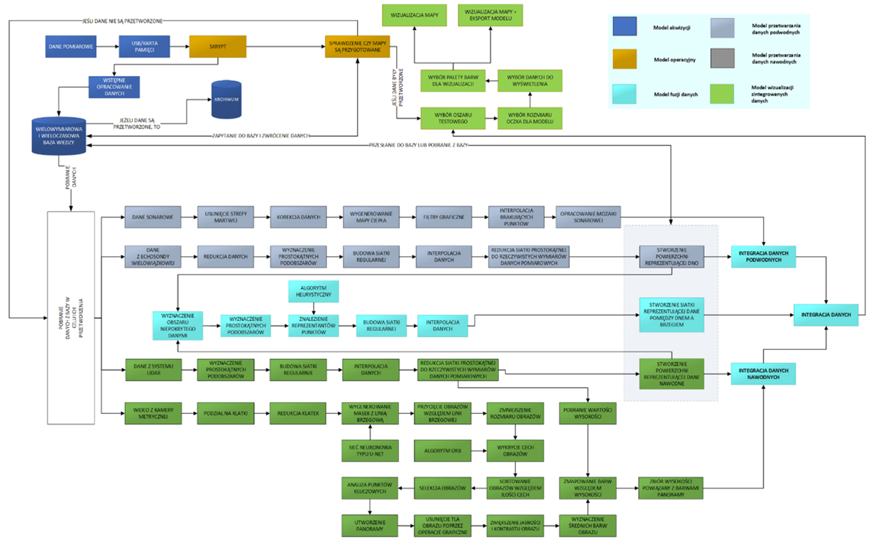
The 4DShoreMap team can boast of its main achievements:
- development of a methodology for using an unmanned vessel to carry out measurements in the coastal zone,
- creation of a new method of fusion of data from underwater and surface sensors,
- completion and implementation of the model of a multidimensional and multi-temporal knowledge base about the coastal zone.
In addition, all milestones have been achieved, which are:
- system data acquisition model,
- system data fusion model,
- model for creating spherical maps of the system.
The architecture of our system itself has also been modified.
In addition, many smaller goals were achieved and we wish to achieve even more successes within our project. 😊